Monte Rosa Tour
The Tour du Mont Rose is one of the most beautiful treks in the Northern Alps, a true journey between Switzerland and Italy on the old Walser dry stone trails.
Tour Details
- Location: Switzerland
- Duration: 8 days
- Difficulty: challenging
- Price: CHF 2200 per person
- Guide: Sarah Kleinknecht
- Group Size: Up to 8
- Elevation Gain: 7450m
- Distance: 107km
- Terrain: Rocky trails, Forest paths, Alpine meadows, Glacier crossings, Valley floors, Mountain passes, Singletrack, dry stone mule track, Fire roads
- Meeting Point: Dorfstrasse 3, 3925 Grächen, Switzerland
Description
The Monte Rosa trek is a true adventure between Switzerland and Italy, exploring the high-altitude trails built by the Walser people. Set amid towering mountains, glaciers, and authentic culture, this journey transports hikers into an exceptional alpine setting—sometimes rocky, sometimes lush—but always dominated by some of the highest peaks in the Alps. It winds through remote valleys in Italy to reach one of the largest ski areas in the Swiss Alps: Zermatt-Cervinia, with the Matterhorn looming overhead. You'll need sure-footedness and good physical conditioning to handle long days at high altitudes while carrying your own luggage the entire way.
Tour Highlights
- Stunning sunrise views from mountain peaks
- Local mountain cuisine experience
- Small group for personalized experience
- Photography opportunities
- Wildlife spotting opportunities
- Expert guide with local knowledge
- Cultural heritage sites
- Panoramic mountain vistas
Itinerary
- Travel day and meeting in Grächen -
We meet late afternoon at the hotel in Grächen and have dinner together.
You can reach the small town of Grächen by train and bus from Geneva, Zürich or Milano.
- Grächen-Saas Fee -
We start the day by taking the Hannigalp lift to leave the resort and join the magnificent balcony trail, which winds its way along the eastern foothills of Balfrin to Saas-Fee.
Overnight stay in Saas Fee - Saas Fee-Macugnaga -
After a quick transfer by bus to the Mattmark dam, we climb up the valley to Monte Moro pass (2,853 m), which marks the border with Italy. Here we join the ancient trails of the Walser people. The immense north face of the Monte Rosa massif looms over us as soon as we reach the pass.
A long descent takes us to Macugnaga resort. We can also opt for the cable car to avoid the 1,500m descent and save our energy for the next day.
- Macugnaga-Alagna Valsesia -
This is the longest stage of the trek. From Macugnaga, we climb up the long Quarazza Valley to Col Turlo (2,738 m) along a dry stone path. From the pass, we reach Valsesia, dominated by the south-east face of Monte Rosa and its Signalkuppe. This magnificent landscape is all the more remarkable as we walk along another exceptional mule track.
- Alagna Valsesio-Gressoney la Trinité -
Today we cross from Piedmont into the Aosta Valley. Vald'Otro treats us to its magnificent Walser architecture. Two mountain passes await us. First the Passo Fornic at 2,432 m, then the Zubecoll at 2,872 m. At Alpe Gabiet, we can take the cable car to Stafal, to lighten an already busy day!
- Gressoney la Trinité-Champoluc -
We set off on foot along the Torrent de Lys to rejoin our route from the previous day at Stafal. The highest point of the day is the Passo del Rothin at 2,689m. The climb is via Sant'Anna and the Salero lakes. From the pass, we continue via the Contenery mountain pasture to the Champoluc valley.
- Champoluc-Theodule pass -
Today's route will gradually give way to a more mineral world. First, there are the meadows around St Jacques, then the Corthoud valley, which leads us into an alpine world, beneath the Cimes Blanches and the Col Nord of the same name at 2,981 m, and there, the splendor of the south face of the Matterhorn. A quick descent to the Lacs des Cimes, the crossing and then the climb back up to Bontardini, and we are already climbing back up to the Refugio del Teodulo for a night at over 3,300m.
- Theodule pass-Zermatt -
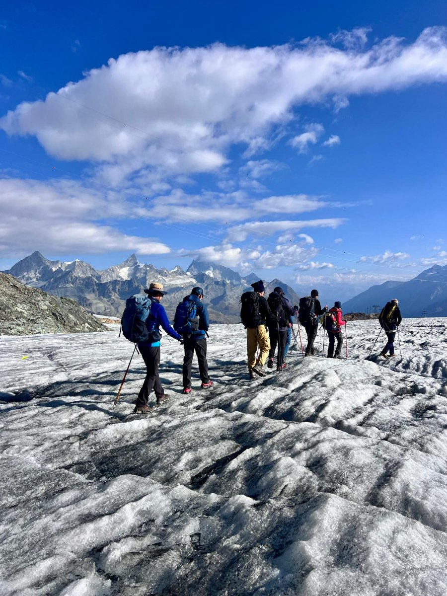
A mountain guide accompanies us across the glacier to the Gandegg hut, then on to Trockenersteg, where we can take the cable car or begin the long descent to Zermatt via Furi and possibly the Gorner Gorge. Our luggage will be at the hostel tonight.
What's Included
- Expert certified guide
- Transportation during tour
- Overnight accommodation
- Breakfast
- Dinner
Not Included
- Transportation to/from starting point
- Personal hiking equipment
- Travel insurance
- Accident insurance (incl. air rescue)
- Healthcare insurance (incl. air rescue)
- Personal expenses
Next Departures
- 6 August 2027 — 8 spots left
Related
Why Book With Made to Hike
This tour is led by a certified mountain guide verified through Made to Hike. All guides on the platform hold recognised certifications such as IFMGA, IML, or equivalent local qualifications. Bookings include secure payment processing, a money-back guarantee, and direct communication with your guide before the trip.